


Fellow urbanites, hello from Wyckoff Avenue!
When we announced our first Tactical Urbanism Adventure, we made a promise: everyone votes on our map, and the highest-voted proposal gets enacted. We’re building a platform to identify, address, and do our damned best to meet the city’s greatest needs.
Then the votes came in and… called our bluff: the winning proposal was to pick up trash along a particularly cigarette-butt-ridden stretch of Wyckoff Avenue in Bushwick. The unpleasantness of the task left us no less motivated.
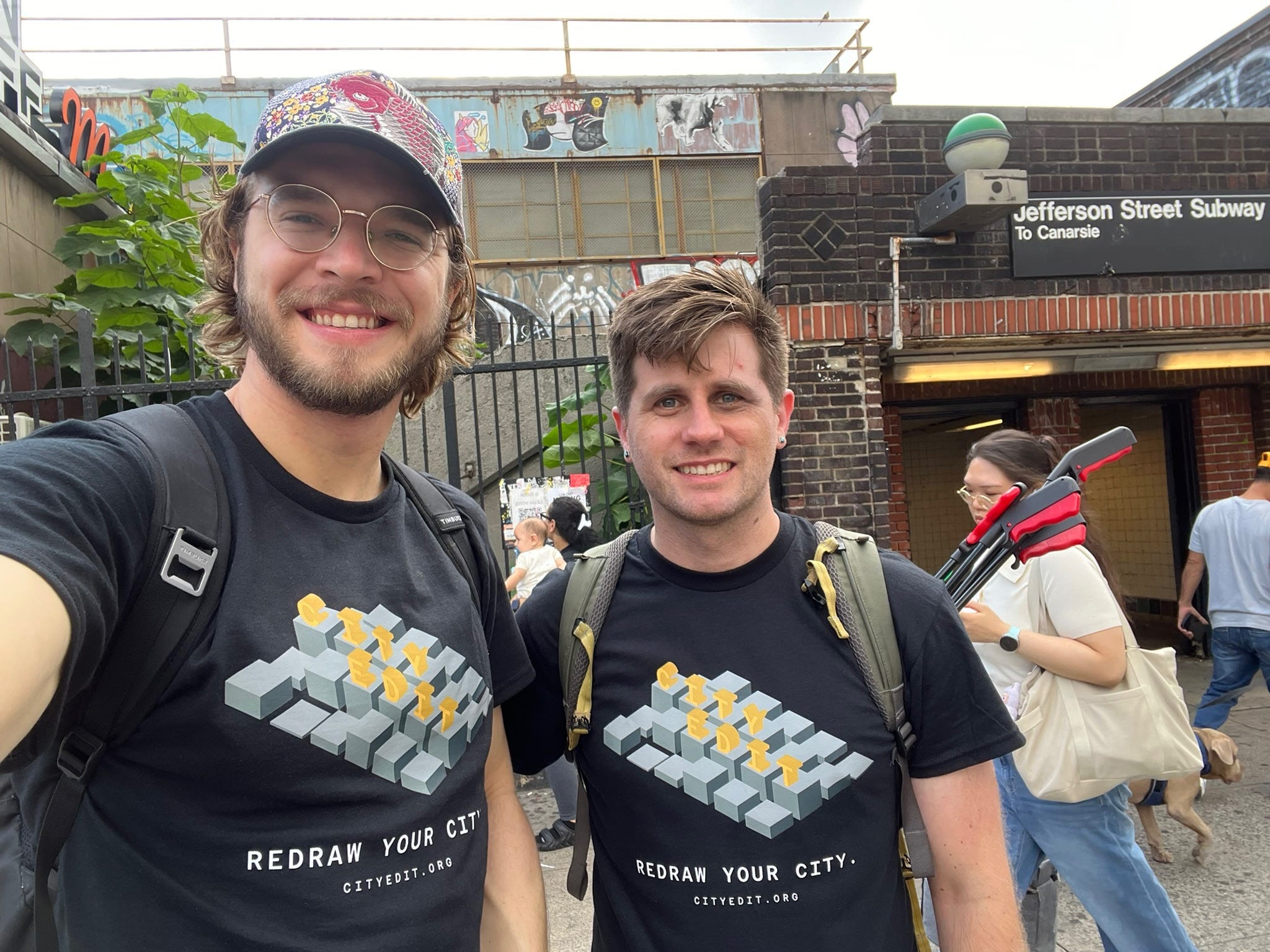
So last weekend, on Saturday morning, a small but determined crew of six met at Knickerbocker Bagel and set off down Wyckoff with grabbers, bags, and gloves.
It was exciting to watch our hypothesis unfold in real-time. Someone had marked a route, others had agreed with it, and a steadfast crew showed up. Eight bags, sixty-five pounds of trash, and one water-logged box of books later, we fixed the most pressing problem identified by our map.
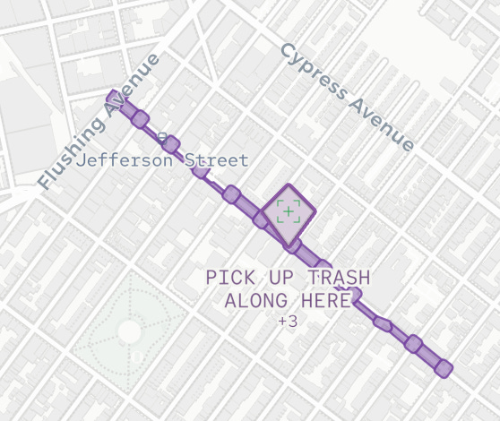
Okay, quick caveat: this winning proposal had only three votes, all by folks already interested in civic tech and to whom we had presented the app at various events in Brooklyn. We can absolutely deliver on “the highest-voted proposal gets enacted.” Whether the map is able to identify “the city’s greatest needs” is still a work in progress.
So today we’re going to be open about our process for getting there, based on what we learned from this inaugural Tactical Urbanism Adventure. First times are always about learning.
We also invite feedback from our readers. The City Edit community ought to have just as much say in our approach as they do in the eventual proposals we enact on their behalf. So as we share our takeaways from the trash walk (it wasn’t just bags of rubbish), please take a minute to share your honest thoughts in the comment section below, and we’ll make sure to enact all of your feedback in our next adventure.
Without further fanfare, here are twelve things our adventure taught us, organized by the four commitments we strive to uphold in our efforts: collective design, fair action, quantitative rigor, and open technology.
🤝 Collective design
Our principal commitment is that our output will be coherently shaped by as many participants as possible. We want to be able to safely say that what we enact was not only impactful, but also harmoniously shaped by a chorus of voices.
Coordinate the right crew of specialists. Six people with identical grabbers began to be redundant. By the second block, hitting the optimal trash pick-up rate required us to go separate ways rather than keeping us together and coordinated.
Next time: let folks claim roles the night before, each with well-defined tasks and deliverables, and prepare work kits against that list: weeder, rake, vacuum, spike, camera (transparent documentation is an underappreciated but crucial aspect of our work!). A crew with clear roles works like a well-designed machine, efficient and effective.
Recruit locally, and recruit actively. The vote told us where to go, but we did not tell the block we were coming. We met plenty of excited neighbors who might have helped had they known about our adventure ahead of time. The best moments of the walk were conversations with passersby about how their streets could be made better. Yet we walked away from all of these interactions without a phone number or email. Short of getting their hands on deck, we might at least have found a way to include their thoughts, advice, and direction for future adventures.
The team at FireStriker, one of our inspirations, perfectly articulates the type of failure mode we want to avoid:The talk of the town in local political circles was a set of data centers being proposed in nearby communities. Big facilities, major implications for water usage, land, and the community’s future. […]
But by the time people got organized enough to start showing up to city council meetings, the papers were already signed. The decision had been made. The window for public input had opened and closed while the community was still figuring out what was happening.
Next time: the winning corridor will get flyers and an announcement on Nextdoor, because the people who live on a block should get to play a part in making it better. And the day of, we’ll bring sign-up sheets for interested folks to participate in future.
Improve the granularity of collective input. “Pick up trash along here” might be painting local desires in too broad of a stroke. Which hotspots along the route most sorely need a clean-up? What type of trash is the biggest nuisance? Is it cigarette butts, wastepaper, or broken furniture? Is it important that we also clean up trash in the gutter, or is it fine to leave that to the street cleaners?
We need flexible language to describe input this versatile. We thought hard about how we might elicit detailed written word proposals, and came up with Tales, a collaborative writing interface that we presented at Wordhack, a talk series at the intersection of language and technology. Learn more by watching our presentation here.
Next time: once the winning proposal is set, experiment with using Tales to ask our community to craft a more detailed proposal for the next tactical adventure.
⚖️ Fair action
Our next core value states that all action we take must fairly represent the community’s desires. It’s not enough to involve only interested parties, since our eventual aim is to countervail the sway of special interests in the city’s politics.
Diversify our outreach portfolio. The map only hears from people with enough free time and interest in civic technology to attend a tech talk or scan a QR sticker on a lamppost. Yet few of the people who spend the most time on the streets meet these criteria: unhoused neighbors, delivery workers, and commuters just trying to get to work. The app as it stands structurally overlooks them.
Next time: Define user stories for people on the street: dog walkers, cyclists, parents with strollers, shopkeepers, bus riders, etcetera, and find the best way to reach each audience. Ahead of our adventure, proactively identify each audience’s needs, and day of, use our boots-on-the-ground meet-up as an opportunity to cast a wider net of input.
Remove bias from our platform. Like we said, what was presented as the winning proposal was made up of only three votes, all from civic-tech-minded people we had personally shown the app to. That is not a fair representation of the city’s desires. Presenting vote counts as a claim about what your neighbors think is a responsibility we can’t take lightly. Michael Suk-Young Chwe explains the risks of misrepresenting others’ views in Rational Ritual:
Social psychologists developed the concept of “pluralistic ignorance,” which refers to a situation in which people hold very incorrect beliefs about the beliefs of others, and is in this sense the absence of common knowledge. To take one of many examples, in a 1972 survey 15 percent of white Americans favored racial segregation, but 72 percent believed that a majority of the whites in their area favored segregation.
That type of gap is precisely what our map is capable of manufacturing. Treating three votes as a mandate is not measuring the block’s opinion so much as dictating it.
Next time: The map will conceal vote counts and top proposals until a user has voted, so as not to bias their initial intent as they use our app.Enforce one person, one vote. As it stands in our app, one enthusiastic voter can make hundreds of proposals to skew the scales towards helping their neighborhood. Additionally, a vote they made months ago would count the same as one they made today. This is not a fair representation of what the community would want for our next adventure.
Next time: we are launching vote normalization per user as a beta feature. Every identity now carries a total voting weight of exactly one, divided among everything they have voted on and weighted by recency. The adventure map’s ranking is recomputed under the budget and republished before voting opens, and we name which proposals moved and by how much.
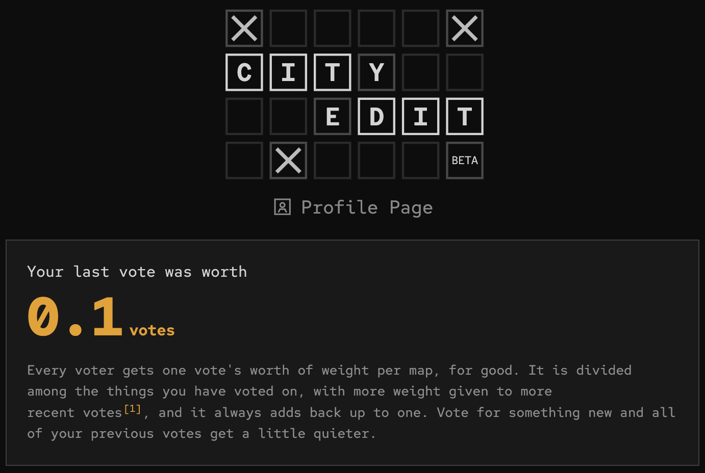
A look into our new profile page view
📐 Quantitative rigor
If we’re going to get better at representing the city’s desires fairly, not to mention measuring our ability to execute on those desires, we need to step up our numbers game.
Plot the numbers. Bags, tree beds, blocks, minutes per block: every future pitch to a funder or an agency will start from figures we measured ourselves. This time, we brought a digital scale, which is why we’re able to write that we picked up sixty-five pounds of trash instead of “a lot.” But a number buried in a paragraph is not as compelling as a detailed data visualization of our work.
Next time: record more granular breakdowns of our measurements so that we plot numbers in a detailed, shareable graphic in our final write-up. That way, our work is legible at a glance.Apply the scientific method. Some participants were more efficient at picking up trash than others, but we had no rigorous way to elicit what worked particularly well for them. To make matters worse, if everyone is going at it with identical grabbers, we have no sense of the counterfactual: no way to learn whether other trash clean-up methods might work better.
Next time: Split our crew into two cohorts, with two hypotheses picked in advance to A/B test what the best implementation strategy might be. At the end, compare performance on key metrics to learn about more effective approaches.
Compare our efforts to past efforts. Sixty-five pounds off one stretch of Wyckoff means nothing until you know what a sanitation sweep pulls off the same stretch, or what the last volunteer cleanup on that avenue reported. There is a long history of exactly this kind of work in this city and we need to understand it to know what our goalposts should be.
Next time: Conduct a short survey of what comparable efforts have reported, aiming to publish these beside our own figures. That way, our final numbers arrive with a baseline attached.
🔓 Open technology
Last but not least, we are committed to developing in the open. That’s why we’re aiming to be public about our strategic thinking around process here.
Publish the plan ahead of time. We waited until a couple days before the adventure to decide on the final location, partly because we were waiting for more votes. To make matters worse, we only decided on a plan for our approach the night before. This made it hard for participants to prepare and impossible for them to weigh in. Furthermore, if other crews around the city wanted to “fork” our plan and enact it in their own neighborhoods, we made no clear public runbook for doing so.
Next time: Ensure the kits, roles, and route decided are made public further ahead of time in a clear and actionable plan, with comments open.
Log our efforts actively. If you open the Wyckoff proposal at the time of publishing this post, there’s no clear record of the trash adventure we conducted.
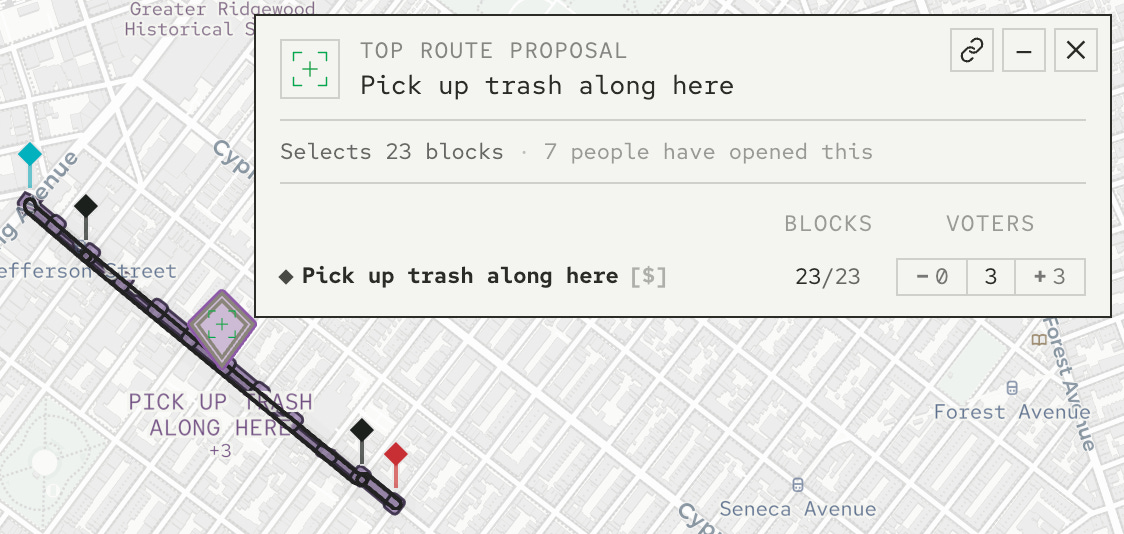
How are future voters to know what’s already been done here? This goes against our ethos of openness, and makes it hard for residents to know what’s already been tried and what the impact was. As a result, our map is harder to use, as folks won’t know whether something proposed has already been addressed, and our learnings from the adventure have no clear way to propagate through the community towards addressing other proposals.
Next time: Include links to digital artifacts of each tactical urbanism adventure (event details ahead of time, post-mortem write-ups like this one afterwards) in their corresponding proposal cards.
Document everything. Our footage from Wyckoff is honest, but a bit shaky. We want to eventually publish short videos about each adventure to get the word out and involve more community members. Now, we have somewhere for that to go: City Edit is on Instagram as harmonica.sphere, but the work of making the first reel is made harder by the quality of footage we collected.
Next time: Bring lapel mics, a selfie stick, prompts for street interviews, and one person whose only job is camera work.
🛠️ Meanwhile, in the app
Speaking of open technology: the codebase has seen a busy three and a half weeks. 250 commits landed on cityedit.org since our last post.
The voting budget is the largest of them, as described above: every identity now carries a total voting weight of exactly one per map, divided by recency on a monthly half-life.
New voter identity management. Ownership of a vote was keyed on the hashed IP address – the same identity the counting uses – so everyone in the same household, office, or school would control the same votes. A vote now belongs specifically to the browser that cast it, plus any signed-in account information (account authentication is coming soon)
Other changes:
Top proposals now say what they are in words beside their pins.
The vote-type menu grew into a proper legend, so every kind of proposal can be toggled on and off on the map.
We made round die-cut QR stickers to pair with the posters, each code drawn as a tiny isometric city that learns its location from the first vote cast through it.
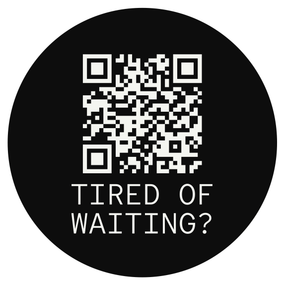
An example of the stickers that we now hand out at events. Votes paint the instant you press them – click time to actualization on heatmap went from 53-105ms down to 2.3-6.2ms
The NYC map gained an accessibility vocabulary of nine vote types, plus the twenty-five street projects DOT itself currently lists as proposals, so official plans and lived experience share one surface.
Profile pages where you can see what each of your votes is worth and take any of them back.
⚡ Tactical Urbanism Adventure, Vol. 2
City Editors,
The people spoke, and we delivered.
Last month the map sent us to Bushwick: Wyckoff Avenue was in need of a trash walk. A small but determined crew of six showed up and cleared eight large bags totaling 65 pounds of trash. Congrats to Katie Soldau for collecting the greatest mass and Kieran Sobel for getting the largest volume, both will receive prizes!
CityEdit is now assembling the Vol. 2 crew for an afternoon of 100 percent permit-free city improvements*: tree bed clean-ups, flower bombs, a proper trash sweep (with better tools this time), and documenting the stuff we can’t fix so the city can look at it.
Where? You tell us. Drop a pin and vote on the map: https://cityedit.org/m/nyc-tactical. The highest-voted block gets the glow-up, location announced a week before. We’ll meet at the nearest best bagel & coffee spot, and breakfast is on us.
Bring: comfy shoes, water, optional gloves. We’re bringing rakes, spikes, paint, chalk, mulch, flowers, trash grabbers, contractor bags, and vibes. No experience needed. If you can water a plant or draw a hopscotch, you’re overqualified.
*Though we’re happy to apply for a permit if folks apply for something that requires one!